Autumn Scenes from the Northeast Kingdom of Vermont (2012)
Caledonia, Essex and Orleans counties in northeastern Vermont are known as the Northeast Kingdom, an affectionate term coined by former governor George Aiken in 1949, referring to the area's natural beauty.
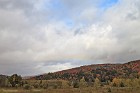
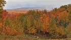
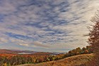
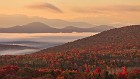
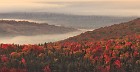
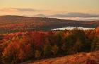
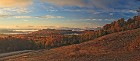
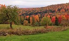
A rugged region of rolling hills, beautiful ponds, pristine forests and hardy people, the Northeast Kingdom is a favorite destination for leaf-peepers. Based on reports from locals that it was the best season for color in years, I set out in early October to see for myself. Despite somewhat uncooperative weather, I was not disappointed, and I don't think you will be either.
A rugged region of rolling hills, beautiful ponds, pristine forests and hardy people, the Northeast Kingdom is a favorite destination for leaf-peepers. Based on reports from locals that it was the best season for color in years, I set out in early October to see for myself. Despite somewhat uncooperative weather, I was not disappointed, and I don't think you will be either.
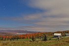
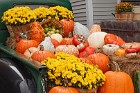 1 Harvest Display at the Vermont Country Store The Vermont Country Store is not actually in the Northeast Kingdom -- it's in Weston, Vermont, in the south-central part of the state. I passed this beautiful harvest display in an antique pick-up truck as I was driving north on route 100 and just had to stop for a quick pic. |
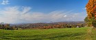
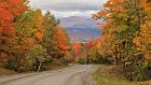 2 Warren Mountain Road View Like the previous picture, this one isn't in the Northeast Kingdom either, but it's a lot closer -- Roxbury, VT. I took this pretty mountain road between Roxbury and Warren on my way north. The day was gloomy but the color was very nice. |
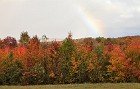
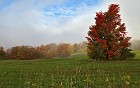
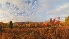
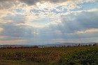
 3 A Break For Color It was quite cloudy and drizzly on my drive up to the Northeast Kingdom, a problem many leaf-peepers had to contend with. Here I was lucky enough to spot a break in the clouds and a low rainbow arc as I was driving on route 12 in Middlesex. The foliage still had a ways to go in this location. |
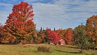
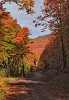
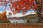
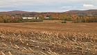
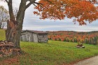
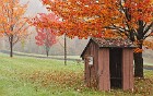
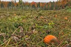
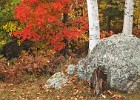
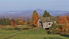
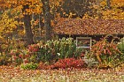
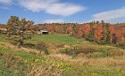
 4 Ready for Thanksgiving I spotted this lovely little harvest setup behind an old wood fence along the winding Calais Road in Worcester, VT. A truly classic New England scene -- these folks were ready for the fourth Thursday in November well ahead of time! |
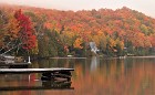
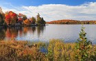
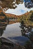
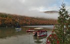
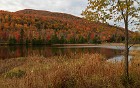
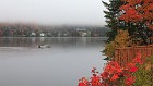
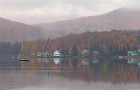
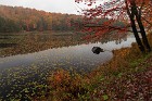
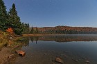
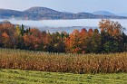
 5 Cottages on Greenwood Lake I rarely go to an area with specific ideas of what I want to photograph, unless it's a famous location with well-known specific attractions (like Yellowstone National Park). In an area like the Northeast Kingdom, it's best to just meander and see what interesting opportunities present themselves. This shot shows lovely not-quite-peak foliage brightening the hills along Greenwood Lake in Woodbury, Vermont. I had never been here before, but I wouldn't mind going back! |
 6 Natural Colors and National Colors A simple display of patriotism, New England style, near a driveway off Newark Pond Road in Newark, Vermont. |
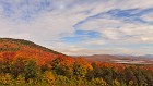
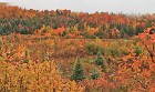
 7 Cloudy Brilliance Several of my leaf-peeping friends recommended that I drive Stannard Mountain Road between Hardwick and Lyndon to catch some beautiful views of colorful mountains in the distance. The low cloud deck prevented that from working out, but the color along the road was absolutely brilliant. If you think the color here is unrealistic, trust me -- it was that kind of year in northern Vermont. |
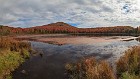
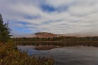
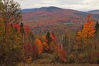
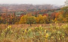
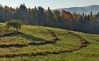
 8 Stannard Mountain Road Vista A view of the mountains in the southwestern part of the Northeast Kingdom, taken from Stannard Mountain Road. It was too gloomy and humid to see very far, but the foliage was out in force. |
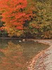
 9 Above and Below One of several rainbows I was lucky enough to see on this generally cloudy day, with complementary foliage color along Stannard Mountain Road in Wheelock, VT. |
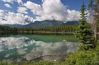
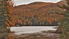
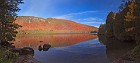
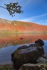
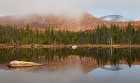
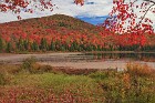
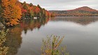
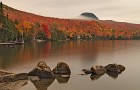
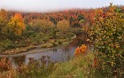
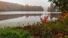
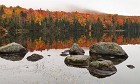
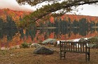
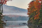
 10 Long Pond -- First View This was my first stop at the beautiful Long Pond in Westmore, VT. The color was amazing but the place was pretty socked in, so I made a couple of additional stops here. You'll see more of Long Pond later in this SceneSet. |
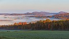
 11 Early Morning Clearing Based on some pretty spectacular pictures I had seen taken from the location, I chose to spend my first night in the Northeast Kingdom at the famous Lewis Pond Overlook. This is a very remote spot near the Kingdom State Forest in far northeastern Vermont; it's only a few miles from Island Pond as the crow flies, but getting there requires a drive of over 30 minutes each way on rather rough dirt roads. It had been cloudy and drizzly all day despite forecasts that the skies would clear by late afternoon. I arrived at the overlook hoping to take star trail pictures, but it was not only still cloudy, it was raining. I caught a few hours' sleep and by 5 am, the sky was beginning to clear, and the moon, setting to my west, lit up the mountains and valleys to the east. This was my first image of what turned out to be a spectacular early morning of photography, featuring wonderful celestial objects, a great sunrise, and amazing fall foliage. The bright "star" top center here is Venus. |
 12 Orion and the Space Station Over Lewis Pond Clouds streamed over me from west to east as the sky slowly cleared and I took more night photos from the Lewis Pond Overlook. At around 5:30 I set up to take some images including Lewis Pond itself, when I noticed what appeared to be a bright star moving steadily across the sky. I am pretty sure that the "star" was in fact the International Space Station. I quickly set up for a 30-second exposure, which led to the streak you see in the center of this image; the breaks in the line are from clouds. To the right of the streak you can make out the star pattern of Orion, his belt prominent. Below the sky show you can see the layered hills of northeastern Vermont at peak foliage (and during an exceptional year), valley fog, and Lewis Pond bottom center. |
 13 A Hint of Dawn This image was taken about fifteen minutes after my first Lewis Pond night shot, and shows a wider view of the scene looking east. It was still very dark, but by this point enough of the clouds had cleared, and enough time had passed, for the first hints of pastel dawn colors to be visible on the horizon on this time exposure. I liked how the faint orange and yellow bands complemented the fall leaves in the distance. The bright spot, again, is Venus. |
 14 Moonlit Hills In this wide night view looking south over Lewis Pond towards Victory State Forest, light streams in from a setting, waning moon, illuminating brilliant fall foliage on the Northeast Kingdom's rolling hills, as well as interesting ripple-patterned clouds. |
 15 Streaming Media This was the last moonlight image I took from the Lewis Pond Overlook before the brightening dawn sky started to overtake the moon and make it too difficult to balance the brightness of the sky and ground. This time I chose a longer, two-minute exposure, which stretched the stars into short star trails, and the skies into streaming ribbons of bluish-white. |
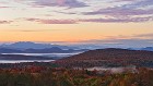
 16 First Rays The very first rays of the sun light up the underside of low clouds streaming eastward over the northeastern corner of Vermont. This image was taken almost a full hour before the actual sunrise, and required a 30-second exposure to make the pink clouds visible against the brightening night sky. Illumination of the beautiful fall foliage was assisted by the moon, setting behind me in this viewpoint. |
 17 Stillness A peaceful close-up of Lewis Pond taken about a half-hour before sunrise. It was a truly beautiful morning, with fog settled in the valleys, and wisps of mist drifting around the completely flat and still pond. |
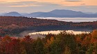
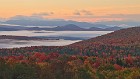
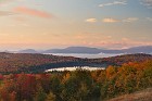
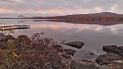
 18 Pastel Valley The nearly-risen sun turns the sky various shades of pink, orange and yellow, matching the foliage colors in one of the many undulating valleys of Vermont's Northeast Kingdom. |
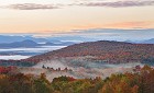
 19 A Most Desirable Place In 2006, the National Geographic Society honored the Northeast Kingdom of Vermont with the label of the "most desirable place to visit in the country". It's easy to see why, especially if you're lucky enough to be there during peak foliage in an excellent year, watching the sunrise turn the clouds rose-colored over the Kingdom's misty valleys and rolling hillsides. |
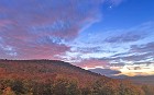
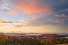
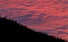 20 Angled Fire About twenty minutes before the actual sunrise, the color in the sky looking east over the Northeast Kingdom reached its maximum intensity. This was one of the best early morning color shows I've ever seen. The sky was so brilliant that any attempt to preserve the colors of the foliage below it would have looked rather unnatural, so I opted to keep the spotlight on the red cloud layers with this silhouette. |
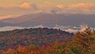
 21 Acceptably Redundant On a morning like this one, it's hard to stop shooting. Every time you look in any direction, there's a spectacular view and golden light and you feel like you simply must press that shutter button. A couple of weeks later you look through the shots and see so many images that look similar, but have enough subtle differences that you want to keep them all. Even after making some rather tough choices, I ended up with a number of rather similar views of the gorgeous hills and valleys of the Northeast Kingdom.. but that's a nice problem for a photographer to have. |
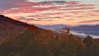
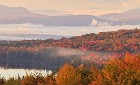
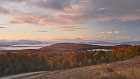 22 Pink and Red By about ten minutes before the actual sunrise, the beautiful color in the clouds had migrated away from the east and towards the middle of the sky at my location on top of the Lewis Pond Overlook. The clouds and trees in this wide view looking south over the Nulhegan Basin put the lie to the old fashion maxim about pink and red not going well together. |
 23 Gilding the Lily "To gild the lily" means to ornament or embellish something that is already beautiful and does not require it. While the connotation of the phrase implies wastefulness or folly, I don't think anyone would complain about the addition of golden pre-sunrise tones to the picture-perfect peak fall foliage in this image of Vermont's Essex County. |
 24 Breathtaking Just as I thought this exceptional morning of light and color could not be any more exceptional, the sun crept closer to the horizon and illuminated the low clouds flowing past me with glowing shades of orange and pink. This image was chosen as the Table of Contents backdrop for the Autumn 2015 edition of Vermont Life magazine. |
 25 Lewis Pond -- Front and Center One of the "rules" of landscape photography is not to place the main subject in the center of the frame, but sometimes rules are made to be broken. This image of Lewis Pond from above was taken mere moments before the sun finally crested the horizon. |
 26 First Light Up Close This telephoto close-up shows the first rays of reddish light hitting both the hills south of Lewis Pond and some of the drifting valley fog. |
 27 The Pond's Edge Another close-up from the Lewis Pond Overlook, taken just minutes after sunrise. This image shows the beautiful peak foliage on the western edge of the pond, with wisps of fog floating just above the water. Interestingly, while this area is mostly deciduous forest, the trees immediately around the perimeter of the pond are evergreens. |
 28 The Day Begins The sharply-angled rays of the early October sun began to illuminate the brilliant fall foliage a few minutes after sunrise, marking the beginning of a beautiful day. Of course, my day had begun three hours earlier, but that's the life of a landscape photographer. :) |
 29 Mist Over the Silvio Conte Wildlife Refuge This photograph is essentially a zoom-in of the left portion of the preceding image, showing the details of layers of trees in the Silvio Conte National Fish and Wildlife Refuge. I really liked the contrast between the brilliant fire of the sunlit deciduous foliage, and the misty, subdued tones and shapes of the evergreens hiding in the fog. |
 30 Lewis Pond -- Peak Plus Some leaf-peepers say that the best weather for appreciating fall color is under overcast skies, or when it's lightly raining. It's true that soft light and moisture can help bring out the saturation of the leaves, especially in photographs, but nothing comes close to the magic of warm golden hour light hitting peak foliage. The colors just burst to life, as you can see in this view of the trees and hills surrounding Lewis Pond. |
 31 Good Morning Northeast Kingdom Taking panoramas is tricky near sunrise or sunset because of the changing light, but by acting quickly I was able to capture a sense of the amazing view I had from my vantage point high above northeastern Vermont. |
 32 Shades of Gold While walking around the Lewis Pond Overlook, I noticed several patches of brilliantly-colored leaves on small maple saplings. It was too dark to really appreciate their beauty for most of the time I was there, but that changed once the sun came up and bathed the scene with its warmth. The yellow, orange and red of the leaves exploded in a display that reminded me of various shades of gold. |
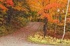
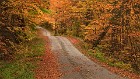
 33 Lewis Pond Overlook Pullback The Lewis Pond Overlook was so beautiful that I could have stayed there all day. But there was a lot more of the Northeast Kingdom to see and photograph, and so about a half an hour after sunrise, I packed up my gear and prepared to move on. My last photo from the area was this "pullback shot" showing the tree-lined path leading to the overlook (which is a simple circle made of concrete blocks). If you ever get a chance to visit this place, it's definitely worth the drive. |
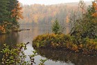
 34 Lewis Pond Panorama The roads around Lewis Pond were so ragged and confusing that it took me a half an hour to get from the overlook to the edge of the water itself, even though I had been only a few miles from the pond "as the crow flies". I got there just as the last vestiges of morning color were leaving the clouds. Lewis Pond turns out to be a lot more interesting from above than it is up close. :) This is probably just because the view from the Lewis Pond Overlook allows you to see a wide stretch of mountains and valleys, while from here you mostly have sky and water. Still, it's nothing to sneeze at! I did notice again here how interesting it was that the forest was mostly deciduous except right along the shoreline. |
 35 Lewis Dock This is an image of Lewis Pond taken facing the opposite direction from the panorama in the preceding image. There's a nice, old-fashioned wooden dock that presumably is used for boat launches during warmer weather. Note the tiny clump of bright red foliage near the base of the dock; you'll be seeing more of that soon. :) |
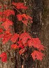
 36 Sugar Baby A close-up of the baby sugar maple growing at the base of the Lewis Pond dock, as seen in the preceding image. The color was truly spectacular this year, and it was everywhere. |
 37 Lost in the Refuge This foliage season was so amazing that I actually had what I call a "nice problem": every time I turned a corner there was another display of fantastic color, but I couldn't stop to photograph them all! That said, after driving around for a while on confusing dirt roads in the Silvio O. Conte National Fish and Wildlife Refuge trying to find my way back to "civilization", I couldn't resist the brilliant color in this scene. The clouds are pretty cool too. |
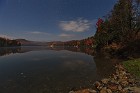
 38 Beautiful Morning on Island Pond The names of some landmarks have long and fascinating histories. And then there's Island Pond, which is.. a pond with an island in it. :) The town of the same name is located along the pond's north shore; this image was taken from the south shore, showing a couple of cottages and some of the early morning fog starting to lift and burn off. |
 39 Off Charleston Road A simple morning view of gorgeous fall color and soaring high clouds in the Northeast Kingdom, taken from the side of Charleston Road just west of Island Pond. |
 40 Seeing Red at Jobs Pond Jobs Pond is an irregularly-shaped body of water located about half-way between Island Pond and Lake Willoughby. When I pulled up to the shore, I was greeted by the most spectacular display of foliage I had ever witnessed -- in particular, the number of brilliant red maples was truly astounding. This is a seven-image panorama. The slightly hazy appearance on the left side is due to some fog that hadn't yet completely burned off the pond's surface. |
 41 Ripples and Rocks A more "artistic" view of Jobs Pond, showcasing the incredible fall color on this brilliant October morning. |
 42 The Opposite Direction The preceding two images of Jobs Pond were taken looking west from the boat launch; this was the view looking in the opposite direction. It's amazing how you can get such a different look, depending on whether you are shooting towards or away from the sun -- I really liked the illumination of the fog and the backlit leaves here. |
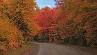 43 Bend on Abbott Hill Road Abbott Hill Road runs north from Burke, Vermont, through the rolling hills and past Jobs Pond. The entire drive was beautiful but the brilliant color on this bend in the road demanded my attention... |
 44 Sparkling Newark Pond Newark Pond is located just east of the southern tip of Lake Willoughby, and like seemingly everywhere in the Northeast Kingdom in 2012, had a banner year for foliage. This image, taken right from the aptly-named Newark Pond Road looking south, shows trees in full bloom, a few cottages, and mid-morning light sparkling on the water. Above the pond you can see the clouds that would very shortly move in and hide the sun for the rest of the day -- a pattern that repeated far too frequently on this trip. |
 45 Foggy Ridge A simple foliage scene taken from East Ridge Road in West Burke, Vermont. I was attracted to this scene by the contrast of the red-and-green foreground tree and the more pastel yellows and oranges in the background. Normally there wouldn't still be fog this thick over land at 9:30 in the morning, but it was quite humid this particular week, and quite a lot of it tends to accumulate in the basin around Lake Willoughby. |
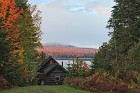
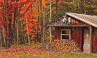
 46 Little Red Cabin on Long Pond Road -- Farther and Narrower While driving on Long Pond Road past Newark Pond, I came across a lovely scene with a pretty little red cabin and brilliant red trees to match. I just had to stop and check it out; I took two images of the cabin and couldn't decide between them, so you get them both. This one was taken from farther away, framed by an apple tree and some rocks. |
 47 Little Red Cabin on Long Pond Road -- Nearer and Wider While driving on Long Pond Road past Newark Pond, I came across a lovely scene with a pretty little red cabin and brilliant red trees to match. I just had to stop and check it out; I took two images of the cabin and couldn't decide between them, so you get them both. This one was taken from closer in, and shows a wider view with a spectacular sugar maple in full fall glory. |
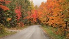
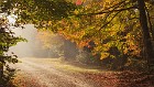
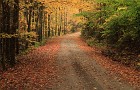
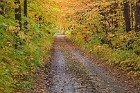
 48 Winding Through Westmore A morning drive on the winding, narrow Long Pond Road near Westmore, Vermont. The foliage in this entire area was simply spectacular. |
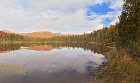
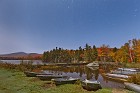
 49 Long Pond Peekaboo Most photos of Long Pond are taken from the boat launch at its north end. This is a different view, peeking through some trees and rocks on the east shore. |
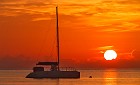
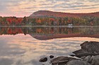
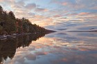
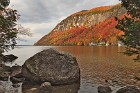
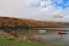 50 Sailboats on Lake Willoughby Lake Willoughby is a dog-leg shaped glacial lake in Orleans County, on the western side of the Northeast Kingdom. It was carved by the action of ice sheets over thousands of years, resulting in a long, narrow, deep body of water with steep cliffs on the sides. In some ways, it's almost like a "freshwater fjord". Because the lake is deep it stays very cold, and very thick fog tends to form on and around it that can last for hours after sunrise. I captured this pretty scene at the lake's south shore, where some sailboats (and other boats, as you'll see shortly) were parked. |
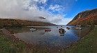 51 Lake Willoughby Panorama A wider view of Lake Willoughby, looking north from the south shore. The cliff-like mountain on the right is called Mount Pisgah; the one on the other side of the lake is Mount Hor. I believe they were at one time connected, until glaciers carved out the lake. On the right edge of the water here you can see the Lake Willoughby boathouse, which has been slowly sinking into the proverbial sunset for years. It's either a classic example of rustic Vermont charm, or a horrible eyesore, depending on your perspective. :) |
 52 Christmas in October This shot of boats on Lake Willoughby is somewhat similar to the previous one, but from this angle you can see this cool little evergreen tree that was growing near the shore. It had a red-leafed vine wrapped around it that reminded me of a holiday not due for many more weeks... |
 53 Enclosed My favorite dirt roads are the ones where the trees are thick right along the edge, and their branches hang over and intertwine, making you feel almost like you're driving right through a forest. This is a dead-end forest road near the Doloff Ponds, tiny patches of water in the southern part of the Willoughby State Forest. |
 54 Dolloff Pond Symmetry A perfect reflection of orange fall color and lifting mist above the shore of one of the Dolloff Ponds south of Lake Willoughby. As I was writing this description, I noticed that evergreens line the shore here, as I observed at Lewis Pond. There must be some sort of biological reason for this... |
 55 Dolloff Pond Wide A wider view of the southern Dolloff Pond in Willoughby State Forest. |
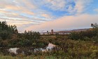
 56 Stopping on Lynburke Road Lynburke Road, also called Route 5, is a two-lane highway that runs from Lyndon, Vermont, north through the town of Burke, continuing past Crystal Lake to Barton. (Not hard to figure out where it gets its name!) A number of small ponds and marshes dot the valley it traverses, most of them with no publicized names; this one had a nice foreground of grasses and backdrop of autumn color. |
 57 Wheeler Pond Postcard On the first day of my travels around the Northeast Kingdom, I decided to go up Wheeler Mountain Road to see what I could find. I pulled up next to Wheeler Pond, walked down an embankment, and found this perfect postcard, with brilliant foreground and background color, just sitting there waiting for my camera. The sun even ducked out from behind the clouds for me briefly, and I rushed to quickly snap some pictures before it faded. |
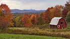
 58 Another Wheeler Pond Postcard This image was taken only a minute after the previous one. The two differ only slightly in terms of composition and angle, but I couldn't decide which one I liked better, and since the scene and color were so amazing I decided to stop trying. :) Wheeler Pond is located right on the western edge of the Willoughby State Forest, actually straddling the boundary -- the eastern half is in the state forest, while the western half is not. |
 59 Clouds Over Wheeler Pond A panoramic view of Wheeler Pond, showing the few breaks that remained before the clouds took over for another day, in what was a mostly gloomy week weather-wise. |
 60 Looking Out Over Crystal Lake Most years you'd be thrilled to find a few trees this brilliant, but after a day or so this particular season, it was easy to start taking them for granted! This overview is above a boat launch on the southern edge of Crystal Lake, a roughly rectangular body of water about two miles long located near the town of Barton. |
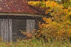
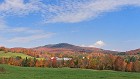
 61 The Pretty Little Barn Eighteen Miles from Jay Peak Meandering the back roads near I-91 south of Newport, Vermont, I ended up on a dead end street where I found this cute little barn. It had a lovely view northeast over the valley that separates the Green Mountains from the Northeast Kingdom, with the pointy pinnacle of Jay Peak -- a popular ski resort -- visible eighteen miles in the distance. |
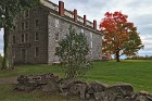 62 Old Stone House A huge building that seems out of place in the rolling countryside of the Northeast Kingdom, the Old Stone House has a long and treasured history. It was built between 1834 and 1836 by Alexander Lucius Twilight, famous for being the first man of African-American descent to receive a bachelor's degree from an American institution of higher learning (Middlebury College in Vermont). An educator himself, Twilight was hired as principal of the Orleans County Grammar School in Brownington. He expanded the teaching facilities of what was also called the Brownington Academy, which was so successful that it started to attract students from other New England states as well as eastern Canada. Receiving no help from local authorities, Twilight designed and raised the funds to build this structure to serve as a dormitory for his students; he named it Athenian Hall. The oldest granite public building in the state, it is now called the Old Stone House, and is the centerpiece of a museum of the same name that is run by the Brownington Historic District. Twilight would later win a seat in Vermont's state legislature, making him the first man of African-American descent to be elected to a state assembly in the United States. |
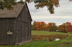 63 Lawrence Barn at the Old Stone House Museum A pretty, mildly toned autumn scene from the Old Stone House Museum in Brownington, Vermont, showing part of the Lawrence Barn. This English-style barn dates from the early 1800s, but was not an original feature of the Brownington Academy property -- it was moved here in 1997. Named for Roland Lawrence, it resembles another barn that was once located near the Old Stone House, and now houses an exhibit on the history of farming in Orleans County. |
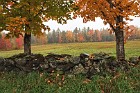
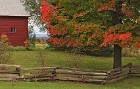 64 Behind the Old Wooden Fence Split-rail wooden fences came into wide use during pioneering days because they are easy to make and can be assembled without the need for any nails or other fasteners (which were often expensive and hard to come by at that time.) Today they are appreciated more for their asthetic and historic value -- by both landowners and photographers. :) This image was taken not far from the Old Stone House Museum in Brownington. |
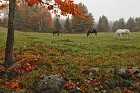
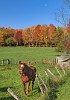
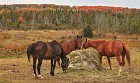 65 Equine Lunchtime Some horses pause for a mid-day meal. I have no idea why the foliage in the background is brilliant orange and red on the right side of the photo and mostly dull yellow on the left, despite all being on the same small ridge. Fall color can be strange that way sometimes... |
 66 Confetti Well I found this cool decorative well on a front yard on the northwest edge of the Derby Town Forest near Newport. Large maple trees above were dropping colorful confetti all around me as I shot. |
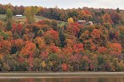
 67 Lake Salem Reflections Lake Salem is actually a pair of lakes located just southeast of the town of Derby, near the Canadian border. The main one, to the northwest, is larger and deeper, and is the body of water usually referred to by the lake's name; the smaller one to the southeast is connected to its big brother by a small stream and marshland. I took this image from Hayward Hollow Road, which runs between the two -- it shows more great foliage typical of this year along the edge of the smaller lake. |
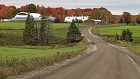
 68 A View of Lake Salem Real estate people say that the three most important considerations are location, location and location. This house has a pretty nice one, on a hill overlooking spectacular fall color along the shore of Lake Salem. I took this image from a considerable distance away using a telephoto lens. |
 69 Stubble The remnants of harvested corn fields create photographer-tempting patterns, while colorful foliage surrounds Lake Salem in the background. |
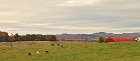 70 Cloudy Pasture Cows graze a peaceful pasture on a farm near Derby Line, about a mile from the Canadian border. The sky was fully overcast by this point of the day, but they had some interesting rolling patterns that almost matched the fields below them. |
 71 S Curve Farm There's something irresistible about an S curve on a dirt road, especially when it leads to a classically quaint Vermont farm during the peak of a brilliant foliage season. This scene was captured near the small towns of Holland and Tice in the northwestern corner of the Northeast Kingdom. |
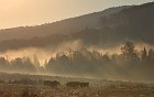
 72 Richardton Dump Wagon Driving along School Road in Holland, Vermont, I spotted some pretty foliage past a farmer's field, next to some harvesting equipment. I actually had no idea what this little red thing was, at first, but was able to make out the name "Richardton" on the full-resolution image, and Google did the rest. |
 73 Pastoral Elements Another peaceful rural scene I discovered wandering the back roads of far northern Vermont, miles away from even mid-sized towns. |
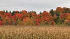 74 Almost Like a European Flag Clouds, brilliant foliage and corn ready for harvest create a tricolor of sorts in a farmer's field near West Charleston, Vermont. |
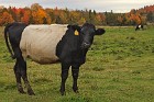 75 Woolly Bear Cows These cows are actually Belted Galloways, but I always call them Woolly Bear Cows -- for obvious reasons. :) I have this thing for cows, so please forgive me if it seems like I take an excessive number of pictures of them. They're really quite remarkable creatures -- I'm always amazed at how observant and gentle they are, especially when I get up close as I did here. Moo. |
 76 Echo Lakeshore A fiery sugar maple is reflected in the shallow water along the south shore of Echo Lake. Named by Vermont's first Surveyor General for the echoes he heard of sounds near the water, Echo Lake is fed by runoff from the larger Seymour Lake just to the north. It is located between the towns of Charleston and Morgan in Orleans County. |
 77 Rain on Echo Lake Many photographers avoid shooting during rainy weather, and for good reason -- it's technically difficult to get good images, you have to worry about equipment damage, and of course, you get soaked! But I'm a stubborn sort, and fall foliage is one subject where you can actually get good results when things get wet. It was only a light rain, so I ventured out and captured this view of Echo Lake with tiny ripples all over it. The peak in the background on the right is 2100' Elan Hill. |
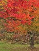 78 Rainbow Tree Solo I've mentioned that 2012 was a banner year for foliage in the Northeast Kingdom, and if you've been looking through this SceneSet, you've seen it for yourself first hand. With so much amazing color, it was hard to justify stopping to take pictures of individual trees -- I would never have been able to stop shooting! Yet even in a year of brilliant color, this tree was a standout, with leaves ranging from green through yellow, orange, red and even a deep burgundy-purple, all on the same branches. |
 79 Kelvin-Helmholtz Instability Bet you never expected to see a title like that while looking through fall foliage pictures! But that's what happens when your photographer is also a weather geek. :) Kelvin-Helmholtz instability, named after physicists Lord Kelvin and Hermann von Helmholtz, occurs when two adjacent fluids are moving at different speeds, creating shear, causing one of the fluids to become disturbed and form wave-like features. This is the process that causes waves to form on the ocean, because the wind is moving faster than the water, but Kelvin-Helmholtz waves can also be seen in the atmosphere under very specific conditions. So, those rippling clouds that look like waves really are waves. This phenomenon is very rare, and I considered myself lucky that it occurred on a day when I was out shooting (and especially, on a day where I was starting to complain to myself about it being too cloudy...) This is a seven-shot panorama, but about half of it was cropped from the right so that the main subject here was more visible. There's a tiny sliver of Echo Lake visible in the background. |
 80 You Turkeys! Wild turkeys are abundant in the rural areas of Vermont, and tend to be seen most often in the spring and fall. I saw a number of small flocks of them, but I had a lot of trouble getting a picture I really liked. Wildlife, of course, doesn't tend to pose for the convenience of photographers, and these turkeys aren't the timid, bloated monstrosities that we eat on Thanksgiving -- they are lean, skittish and fast! I was able to capture this flock in front of some (admittedly less-than-exceptional) fall foliage on a little side street not far from the Kingdom State Forest, northwest of Island Pond. |
 81 Light in the Darkness I ended my first full day of shooting in the Northeast Kingdom satisfied with what I had captured, but also very tired from having been up early. I planned to catch up on my sleep that night, but the weather was not cooperating. After being cloudy most of the day, the forecast was for more clouds and rain the next day. When I woke up at around 1:00 am and noticed that the sky was mostly clear, my desire to get some good shots overruled my fatigue, and I set out to capture a few more night images while the opportunity presented itself. This shot was taken at around 2:30 am near a farm on a ridge located roughly in the middle of the triangle formed by Lake Willoughby, Echo Lake and Island Pond. It looks northeast over the valleys and rolling hills of the Northeast Kingdom, showing a view of stars and streaming clouds on what was an unseasonably warm and pleasant night. |
 82 Long Pond Silver Knowing how incredible the color was at Long Pond, I hoped to get a nice star trail image here, but the clouds were too thick in this area (even though it was only a few miles from the previous image's location, where the stars were visible.) There was enough moonlight filtering through to take this two minute exposure. The long duration gave the surface of the pond a beautiful, almost metallic appearance, and gave a soft look to the fog streaming around the small evergreen-covered hill above the colorful foliage. |
 83 Stars and Stripes The usual advice for those wanting to take moonlight photos is to go on a clear night, but interesting cloud patterns actually make night images much more interesting. I stopped at this small, unnamed pond just south of the much larger Norton Pond, and was fascinated by the stripes of clouds that were flowing overhead. This pond is located in Warren Gore, an unincorporated region truly "in the wilds" of the Northeast Kingdom (I saw a bull moose and a black bear in the area before this was taken). The gore includes part of the Kingdom State Forest, and had a population of only 10 in the 2000 census. |
 84 Running from the Clouds After having some success with some moonlight photography, I noticed that the clouds were starting to move in. This had been expected, and in fact, I didn't think I would see anything but clouds on this day. I stopped at Island Pond at around 5:30 am and found a place where I could get online, and loaded up an infrared satellite loop. The storm was moving in from the southwest, and it looked like I might be able to find some breaks in the clouds if I went further north. So I scrambled up route 114 to Norton, where the road comes close enough to see the Canadian border from one's car, and then headed east, figuring I would go as far as I needed to until I found some light or "ran out of Vermont". I arrived at Great Averill Pond as dawn was breaking, and was treated to an unexpectedly lovely day breaking with beautiful cloud patterns. |
 85 Tiger Sky Striped low clouds contrast with pink high clouds at dawn on Great Averill Pond, complementing fantastic foliage along the shoreline. Not bad for a morning that was supposed to be a bust! |
 86 A Spectacle at Great Averill Pond The peak of pre-dawn color during my morning at Great Averill Pond. The colors and patterns in the sky, along with the matching water reflections, were truly mesmerizing. |
 87 View from Cottage Road The aptly-named Cottage Road runs along the northeast shore of Great Averill Pond. The view from behind this cottage must have been spectacular, but I don't like to trespass onto private property, and since the cottage itself was kind of pretty, I decided to make it a subject along with the pond. :) |
 88 Pink Marsh The last pink pastel tones of early morning are seen here over a small marsh located just to the north of Great Averill Pond. |
 89 Foggy Forest Lake My next stop after Great Averill Pond was Forest Lake, just to its east. There's no general agreement on what makes a body of water a "pond" as opposed to a "lake", but usually size is at least some part of the consideration. Thus, it's kind of funny that Great Averill Pond is at least ten times the area of Forest Lake. The lake was completely socked in with pea-soup fog, so thick you can barely make out the far shore in this image, even though it was only a few hundred feet away. There was a beautiful maple in full foliage display above a small boat on the shore that was impossible to resist. |
 90 Self-Portrait of a Landscape Photographer Sometimes you find yourself between the sun and the shot you want to get, especially near sunrise or sunset. The result is a scene as close to a self-portrait as you will ever get out of me. :) The color was absolutely dazzling in this spot, and the golden light helped further. The phot was taken near the intersection of two winding dirt roads near Canaan, Vermont, in the northeastern part of the Northeast Kingdom. Note the nearly full moon, top center. |
 91 A Beautiful Drive in the Country As the clouds from an approaching storm moved in, I continued to head east so I could take as many pictures as possible with morning light, before it went away. Canaan Hill Road meanders across the far northeastern part of Vermont and was a truly wonderful experience, as I enjoyed peak, brilliant fall color illuminated by golden early sunshine. This is what fall in Vermont is all about... |
 92 Stunned on Canaan Hill Road While driving on Canaan Hill Road, I came around a corner and found this scene before me: perfect peak color in the trees, their tops illuminated by the angled morning sun; fields of wild brambles also turning fall shades in the foreground; a fog-shrouded hill behind; and incredible cloud patterns above. Amazed, I pulled over as quickly as I could to capture the view before it disappeared. This required wandering into a dew-wet field full of thistles and other wild weeds, and it took me ages to get all the burrs off my clothing afterwards.. but it was so worth it! |
 93 Northeast by Northeast A wider view of the same scene shown in the previous image, but taken from a slightly different angle. This panorama shows the heart of the northeastern part of the Northeast Kingdom, including part of the Canaan Town Forest. |
 94 International Waters A small boat chugs across the water under a thick blanket of fog. Wallace Pond straddles the US-Canadian border, with about three quarters of it north and one quarter south. Much of the border between the two nations in this area is on the "honor system"; there's even a road -- the aptly named "Canusa Street" -- where one side is in Beebe Plain, Vermont, and the other side in Stanstead, Quebec. |
 95 Connecticut River Color I found some very nice color right along the banks of the Connecticut River in far northeastern Vermont. Usually, the relatively low elevation of the Connecticut Valley leads to the color being rather poor there. But this far north -- not far from the river's source in New Hampshire -- the river is much narrower than it is in southern New England, and the elevation is higher. These factors may be partly responsible for the nice color progression. I was still a bit surprised at how nice the foliage was, but then, it was that kind of year in the Northeast Kingdom. |
 96 Livestock Assortment I was amused by the variety of livestock here -- cattle, sheep and alpacas -- on what was obviously a small hobby farm of some sort. This was taken near Beecher Falls, in the little "tab" of land in extreme northeastern Vermont, an area actually surrrounding by New Hampshire on three sides. |
 97 Christmas Trees in the Conn Valley It must take a lot of patience to be a Christmas tree farmer. :) I found these fine specimens growing next to a dirt road off Route 102 in the Connecticut Valley, in front of a hillside ablaze with fall color. |
 98 A Break of Blue Near Colebrook By 9:00 am I had given up on seeing the sun for the rest of this day. I jotted across the border to Colebrook, New Hampshire, to get some food and take a break. While there, I noticed the sun had come out! Realizing it would not last, I jumped back in the car, headed back to Vermont, and captured this lovely hillside off Route 102. It was, indeed, the last blue sky or sun I'd see for almost 48 hours. |
 99 Micropond on Mill Road Wandering the back roads in the eastern part of the Northeast Kingdom, I ended up on a cul-de-sac. There was a small home there and a nicely manicured lawn, in the center of which was a pond that was no more than 50 feet in diameter. But it still had a small dock, and I'd imagine it's a lot of fun to have a pond of any size on a hot summer's day. |
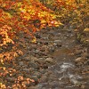
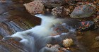
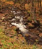 100 Mill Brook Cascade Mill Brook cascades over rounded rocks through a leaf-blanketed forest in the wilds of the eastern Northeast Kingdom. |
 101 Equal Opportunity Forest This hillside struck me as a bit unusual because of how the coniferous and deciduous trees were interespersed -- it's more typical to find them in stands. The mountains in the background were quite colorful, but the rain had started by now and visibility began to decrease. |
 102 Our Neighbor Across the River Nature knows no boundaries, so a great color year in the Northeast Kingdom means surrounding areas will look pretty good as well. This is a view of some of the lower peaks of the far northern White Mountains in New Hampshire, as seen from a dirt road, across the Connecticut Valley, a couple of miles north of the intersection of routes 102 and 105. |
 103 On the Way to South America South America? What on earth does that have to do with northern Vermont? Well, I don't know either, but I wanted to explore in some of the remote country west of the Connecticut River Valley, and when I saw "South America Pond Road", I couldn't resist checking it out. To add to the international confusion, this area is located within the town of Ferdinand, Vermont, which was named after German prince Karl Wilhelm Ferdinand. If you've never heard of Ferdinand, Vermont, that's no big surprise -- it's mostly wilderness, with a population of just 33 spread out over 53 square miles. |
 104 Yellow and Red and the Stream This maple tree had the most amazing foliage -- most of the leaves were red on the edges and bright yellow in the middle, but with little or no orange in between. Quite fascinating. The tree was hanging over the North Branch of Paul Stream, about a half mile north of South America Pond. |
 105 Hunting Cabin in the Middle of Nowhere I happened upon this rustic little hunting cabin in a beautiful wood along Paul Stream Road, north of the Victory State Forest. Located miles from the nearest town of any consequence, it seems like a great place to get away from it all. |
 106 Veins One of the reasons that fall foliage is so beautiful in the northeast is that the color change is non-uniform: you see different colors on different trees, among leaves on the same tree, and even within the same leaf! In particular, the veins of leaves usually change color later than the rest of the surface, and often end up a different shade altogether. This creates beautiful color contrasts, as seen here. |
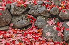
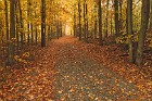
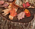 107 On the Block A collection of maple leaves fallen onto a firewood chopping block in a light rain; a microlandscape taken near the hunting cabin shown a couple of images back. |
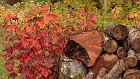 108 Old Wood -- New Growth Firewood logs juxtaposed against colorful new maple shoots provide a timeless reminder of the cycle of life in a hardwood forest. |
 109 Hazy Paddle If you want some time for quiet reflection, nothing beats going out in your kayak on a cool, hazy, drizzly October afternoon. Neal Pond is located about ten miles east of St. Johnsbury, off route 2, not far from the New Hampshire border. I'd imagine that it gets pretty busy on a sunny July afternoon, but today the whole thing belonged to this brave soul. |
 110 The Fallen Most leaf peepers want their foliage to be where it's easy to enjoy -- on the trees! But it stays beautiful on the ground for several days more, like the discards from this maple that I found scattered about some smooth granite rocks. |
 111 The Train Will Not Be On Time Heading towards St. Johnsbury, I saw Miles Pond on my map and decided to check it out. Driving down a perimeter road, I spotted this scene. Apparently these tracks are no longer in use, so some of the residents decided to make better use of them. That bench would be a lovely place to sit and sip a cold drink on a warm summer day.. but it was neither warm nor summer when I was there... |
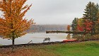
 112 Moose River The Moose River twists and turns through unspoiled wilderness in the heart of the Northeast Kingdom, flowing south to empty into the Passumpsic River near the unincorporated town of Victory in the Victory State Forest. Its waters eventually flow into the Connecticut River and then Long Island Sound and the Atlantic Ocean. I really liked the huge boulders I found in this section, framed by lovely fall color. Due to the weather and the late hour, it was quite dark; this is a six-second exposure. |
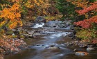
 113 Leaves and Striations A close-up of a cascade on the Moose River showcases wispy water, fallen leaves and colorful rock striations. |
 114 The Infamous Radar Road I ended my second full day in the Northeast Kingdom by traveling down Radar Road, in the wilds northeast of Lyndonville. It was quite pretty, as you can see, with the trees closing in all around me, though strangely there was little orange or red here, very unlike the rest of the region in 2012. It was also a somewhat scary; I'm quite accustomed to driving on dirt roads, but this road was so rough and bumpy, and so remote, that at several times I almost turned around and went back the way I came. The road also gained quite a bit of elevation, with this image having been taken at just over 2000 feet. Even my GPS stopped working here! I later found out that Radar Road is somewhat infamous for being a harrowing experience for the unwary. It was especially so for me as I did it very late in the afternoon on a gloomy day; in fact, it was so dark that this is a 20-second exposure, which is why so many of the leaves look blurry (due to wind motion). |
 115 One of the Worcester Ponds The Worcester Ponds are located in the town of the same name, about five miles north of the state's capital, Montpelier. Located in Washington County, these ponds are technically not in the Northeast Kingdom, but they're close to its traditional western boundary, and Vermonters don't get too religious about such things anyway. :) There are three Worcester Ponds, and they don't seem to have individual names. They're kind of the like the three bears from Goldilocks fame, as there's a big pond, a mid-sized one just to the north, and a very small "baby" pond north of that. This shot is of the "papa" pond, taken on a gray and drizzly day. |
 116 Calais Fall Festival Display I spent this particular day of my trip traveling around with a good friend of mine. We stopped in the town square at Calais, where some volunteers were putting up a beautiful display as part of a fall foliage festival; this is a small part of it. |
 117 Festive Roadside Shack Folks in the country sometimes put out little shacks by the side of the road to sell vegetables or crafts (often on the honor system). There was nothing for sale here today, but the shack itself was looking quite festive, adorned with freshly-fallen orange and red maple leaves. Taken on West County Road in Calais. |
 118 A Quiet Place on Curtis Pond Curtis Pond is an oblong body of water about a mile in length, set in a basin east of a mountain ridge. It's located near Calais town center. This small blue cottage looks like a lovely place to spend some quality time, even on a murky day like this. |
 119 Maple-Framed Two maple trees and a rock wall along Cabot Road in Woodbury frame a view of a pleasant meadow and fall foliage in the background. This image is dedicated to my good friend J, who spotted this composition before I did, showing that she's a much better photographer than she thinks she is... |
 120 Cranberry Meadows Forever Cranberry Meadow Pond is another of the many small ponds that dot the highlands north of Montpelier and west of route 14. Its most notable feature is a small peninsula that juts out into the "neck" of the pond in its southeast corner. It appears that a large rock was deposited here near the shoreline many years ago -- perhaps by a glacier? -- and over time, dirt accumulated around it to form an island. Then, as the island grew, it became connected to the mainland. The peninsula is in the center of this image, with the edge of its large boulder on the right. You can also see on the water's surface that the weather was not exactly lovely. :) The title of this image is for M, my favorite Beatles fan. :) |
 121 Three Horses Three horses graze peacefully in a meadow on Ducharme Road in Marshfield, Vermont. |
 122 Pumpkin Patch at Burtts Apple Orchard I had a great day with my friend J driving around the western part of the Northeast Kingdom. At one point we decided to check out some of the higher elevation spots that were supposed to have great views, but the clouds were too thick to see much. We stopped at Burtt's Apple Orchard just north of Cabot, where pick-your-own season was in full swing. We wimped out on apple picking because of the weather, but I couldn't leave without taking a stereotypical pumpkin patch shot. The stakes in the background are for some of the younger apple trees in the orchard. |
 123 Almost at Cloud Level This layered scene shows milkweeds and smaller trees in the foreground, with a small farm in a valley behind, and then a mountain ridge that forms a boundary of sorts between central Vermont and the Northeast Kingdom. This image was taken from Dubray Road in Cabot, at nearly 2,000 feet of elevation; on this wet day, that was enough to put us almost at the level of the clouds. |
 124 Cabot Plains Brilliance Turning the corner from Dubray Road, my friend and I found ourselves on Cabot Plains Road, where we encountered a field and forest with incredibly brilliant color. Not only were the established tree stands ablaze, but the smaller saplings in the meadow were just as bright and beautiful. You can see from the mist in the background that we were just about at the bottom of the cloud deck here; the soft light and wet conditions helped saturate the colors further. |
 125 Reclamation Project If you clear some land and build a structure in Vermont, you best be prepared to defend it -- or the land will take it back. This rustic old shed was surrounded with grasses, trees and vines beginning the process of reclamation. The blur in the top left corner is a leaf falling at just the right time... |
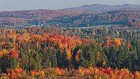
 126 Early Fall in Barnet One of the cool aspects of autumn in New England is that it's so unpredictable, its progress depending on location, elevation, recent weather, and other variables that scientists haven't even figured out yet. You can find patches of peak color less than a mile from areas that have barely started yet, then go around a corner and see trees that are already bare. Barnet is towards the southernmost part of the Northeast Kingdom, and includes the lower elevations of the Connecticut River Valley, which is perhaps why the color was not as advanced here as in adjacent areas. You can see some pretty nice color in the middle of the image, while the hillsides behind are still nearly entirely green -- and I didn't see a whole lot of green trees on this trip! |
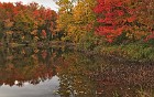
 127 Ticklenaked Pond This is far from the best picture I took on my visit to the Northeast Kingdom. The color is good but not great; most of the trees are evergreen; the lighting is humdrum; and the composition is nothing to write home about. Normally I wouldn't even have included this in a SceneSet at all. But I had to in this case. Why? Simple. This shot was taken at Ticklenaked Pond. No, I am not making that up, but it is certainly the sort of name that upon hearing it, you'd assume it was a joke. :) Located in Ryegate, the pond has nothing to do with unclothed sensory stimulation; the most popular theory seems to be that it is a corruption of the Algonquin word "tickenecket", meaning "place of little beavers". |
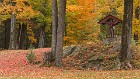
 128 Walking to Noyes Pond Groton State Forest encompasses 27,000 beautiful acres of rugged terrain in the northeastern part of Vermont. Located roughly between Montpelier and St. Johnsbury, most of its territory is in the far southwest corner of Caledonia County, and thus the far southwest of the traditional boundaries of the Northeast Kingdom as well. The primary access to most of the forest is via Vermont route 232, which roughly bisects it. The color wasn't that great in most of Groton State Forest when I was there, so I didn't shoot much within its borders. But I did have a great experience at Noyes Pond, a real gem located off a dedicated access road south of most of the forest's more popular attractions. Noyes Pond was created in the 1890s to service a mill that operated on the site. In 1939, the pond and the area around it was purchased by a wealthy Bostonian named Harry K. Noyes, who built a guest house near the shore of the pond and named the parcel of land the Seyon Trout Ranch. (Seyon, Noyes, get it?) Eventually the property was bought by the state, and incorporated into Groton State Forest. The color around this pond was spectacular; here you can see the path that leads from Seyon Lodge and the parking area to the water, where a couple of inviting wooden chairs were waiting. |
 129 Birch and Maple White birch trunks and orange/red maple leaves contrast beautifully in this microlandscape taken in the forest near Noyes Pond in Seyon Lodge State Park, Groton State Forest. |
 130 Rocky Noyes Pond Beautiful rocks and aquatic grasses anchor this quiet, peaceful view of the south shore of Noyes Pond. The foliage was truly beautiful here, and while the gloomy weather prevented long views of the surrounding hillsides, it also created a stillness that turned the pond's surface into a mirror, and made me feel like I could stay here forever. |
 131 Red White and Gray Granite, white birch trunks and brilliant red maple leaves compete for attention just east of Noyes Pond. Seyon Lodge is about a hundred yards behind and to the right of where I took this photograph. Formerly owned by the Noyes family, it is now run by the state of Vermont's Department of Forests, Parks, and Recreation. It's the very definition of rustic Vermont beauty, with a stone fireplace and room for 16 overnight guests, who can enjoy the pristine beauty of Groton State Forest and Noyes Pond -- hiking, cross-country skiing, fishing and more -- while staying in comfortable accommodations. And to top it all off, it's inexpensive -- under $100 a night as I write this. I plan to bring my wife for a weekend here as soon as we can find a time to get away... |
 132 Noyes Pond Contemplations Another peaceful view of Noyes Pond on a cloudy, quiet day. I can't imagine a better place to sit for a while and meditate or relax -- sit down on that bench and you might have trouble standing up again... |
 133 Trails Over the Highlands The weather on this trip encouraged me to be up half of every night -- the days were constantly cloudy and rainy, and then the skies would clear late in the evening. After taking a lot of images with dreary skies, the stars were too beautiful to resist, so once again I forced myself out of my sleeping bag in the middle of the night and got to work. This seven-second exposure was taken high in the Cabot highlands, over 2000 feet up, west of Joes Pond and north of the Groton State Forest. You can see that even at 2:00 am, thick fog had already settled in the valleys. The image was actually of a rural back yard; you can see a blue picnic table under the small shrub, and some pumpkins in the background right of the maple tree. |
 134 Fosters Pond Firecracker The thing with night photography is that, well, it's done in the dark. :) You can't actually see the whole scene in the way that it appears in photographs, because the eye can't do long exposures the way a camera can. So the smart way to approach this technique is to scout out areas ahead of time where you want to take pictures, mark them in a map or GPS, and then return at night to create images. I usually do that, but this particular night I didn't get a chance to do so before it became dark. So I found myself at 3 am wandering the back roads of the Northeast Kingdom somewhat blindly, hoping to find some worthy subjects. Fosters Pond is located in a small hollow in Groton, just east of the northernmost part of Groton State Forest. The color here was not the best, except for one small maple sapling on the shore. Singleton trees with bright foliage are sometimes called "firecrackers" when they stand out like you see here, and this one provided a nice anchor for this reflective star trails shot. |
 135 Points of Light on Martins Pond Beautiful Martins Pond is located about a mile and a half south of Fosters Pond. For this image I chose an exposure of about 30 seconds, short enough to keep the stars pretty pinpoints, as they appeared to me when I was there. A few clouds were drifting by to add interest, and the blurs in the water are from leaves in motion. At the time I was taking this I was very curious about the odd light pattern I could see on the shore just left of center, but couldn't make out in detail. This turned out to be light rays caused by artificial lights in a cottage coming through the windows and being filtered by the branches of nearby evergreen trees -- very much the way the sun sometimes makes sun rays near trees in the early morning. |
 136 Dawn on Peacham Pond Peacham is a, well, peach of a little town in the southwestern part of the Northeast Kingdom; it was awarded "Best New England Village" in 2005 by Yankee Magazine. It has a lovely town center, and holds a well-regarded fall foliage festival every year. Peacham Pond is located about two miles west of the town, nestled into an alcove carved out of Groton State Forest, which surrounds the pond on three sides but does not include it. The pond has a long peninsula that nearly bisects the water near its northern extent, which is where I took this foggy, pre-sunrise image. |
 137 Fog Rays Combine early morning sun, ground fog and trees, and you get one of my very favorite phenomena. These don't really have a specific name, so I simply call them "fog rays". |
 138 First Light -- Danville Hill Road The first light of day kisses the treetops in this panorama taken from Danville Hill Road (which, oddly enough, connects Cabot to East Cabot, not Danville!) There was very thick fog layered in all of the valleys, due to the rain of the previous day and clear overnight skies. Cabot is famous for the Cabot Creamery Cooperative, which makes, among many products, truly amazing cheddar cheese. |
 139 Cows in the Mist "Gorillas in the Mist" is the title of a 1988 film that tells the story of zoologist Dian Fossey's work with primates in central Africa. It came to mind the second I saw this scene. Of course, this being Vermont, we don't have animals as exotic as gorillas. And this wasn't really mist, it was fog, which the early morning sun was shining through and burning off. But you get the idea. :) |
 140 Cabot Plains Revisited When my friend and I drove the high elevations of Cabot Plains Road, we found the area ablaze with amazing color, but socked in with drizzle and fog, limiting visibility. The result was the image I entitled "Cabot Plains Brilliance". I came back the following morning to check out the scenery under better conditions, and this panorama is what I found (viewed from a wider and slightly different angle). The color up close was actually quite a bit better than what was on display in the distance, but the rolling hills were beautiful nonetheless. |
 141 Distant Farm This close-up of the farm visible on the left side of the preceding panorama, and countryside surrounding it, illustrates a classic New England autumn morning. It also gives you a good idea of the scale of the wider view. |
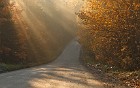
 142 The A M Foster Covered Bridge Covered bridges were invented to help extend the life of wooden bridges, which otherwise tend to rot away after a few years. They have largely been replaced by more modern designs where practicality is the priority, but many existing ones remain in use, and they are favorites of tourists and photographers alike, as they capture the essence of colonial, rustic New England. This one, though, is a bit of an oddity. As you can see, it's somewhat of a "bridge to nowhere" -- it doesn't actually span a river or gorge, just a small ravine. In fact, as the magnificent view probably gives away, it's located high in the hills, at an elevation of almost 2000 feet. The view looks northwest towards the northern Green Mountains. Obviously there were simpler ways to cross a little gully like this, but the owner of the land, Richard Spaulding, had a cooler idea. He designed this span as a replica of a bridge in Marshfield, and named it for his great-grandfather, A. M. Foster, former owner of Maple Glen Farm. That farm is now owned by the Burtt family, who run Burtt's Apple Orchard, just down the road from the bridge on Cabot Plains Road. (I have pictures taken in and near that orchard elsewhere in this SceneSet.) The little pond under the bridge was actually added after it was constructed. |
 143 Apple Orchard Parfait The layers of this image, taken near Burtt's Apple Orchard on Cabot Plains Road in Cabot, Vermont, reminded me of a parfait dessert. From closest to farthest (bottom to top), fresh-cut hay drying in the sun; corn drying in preparation of harvest; staked young apple trees; forest around the orchard; fog in the valley around Cabot and Route 215; and the foothills of the Green Mountains. |
 144 Semicircular A farmer drove his (her?) tractor in semicircles around this small tree on a hill, creating a lovely pattern. |
 145 Maple Lane No, really, that's the name of the street! Perfect, isn't it? :) This lovely stretch of dirt is in West Danville, Vermont. |
 146 The Prettiest Garage I Have Ever Seen This little garage on Peacham Road in Danville, Vermont, is clearly owned by some seriously talented gardeners. If not for the colored leaves, you'd think it was summer with all those beautiful blooms! Add to them the fall foliage, especially that fiery bush on the right and carpet of leaves on the roof, and you have a classic New England autumn scene. There's even a canoe! |
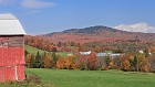
 147 Devils Moon Equine Devils Hill Road is a dead end street off of Green Bay Loop just west of Peacham. I found a lovely corral there with some of the friendliest horses I've ever "met". This fine fellow captured my attention, and then I captured his likeness, with some lovely fall foliage and the setting, waning moon in the background. |
 148 Lifting Fog This was an epic day for fog in the Northeast Kingdom. The combination of a rainy, misty day and a clear, cool night, caused the fog to drop into the valleys and stay there for an incredibly long time. This image, taken on Garland Hill Road in Barnet, just east of Harvey Lake, shows some of the fog still lifting and burning off nearly four hours after sunrise. |
 149 Angles and Curves Normally I wouldn't designate as a "keeper" an image where half the shot consists of a field of brown grass. :) But the other elements and shapes in this photo really appealed to me -- the bright colors of the young trees in the background; the curves made by farming equipment; and the various lines demarcating the fields. |
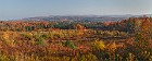
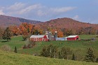
 150 Idyllic Bucolic Scene Every once in a while, you turn a corner, and you're taken aback -- laid out before you is an almost perfect scene, just waiting to be captured. And this was one of those moments, where I just said to myself "wow" and scrambled for my camera. Spectacular color, rolling hills, a pretty little red farm with a pond, and an adjacent dirt road. Behind, a bank of fog burning off a hillside. And above, a crystal blue sky with puffy clouds. It just doesn't get any better than this! This is a panorama taken on Whitehill Road in Barnet. Unfortunately I was not able to figure out the name of the farm. This image was featured in the Autumn 2015 edition of Vermont Life magazine. |
 151 A Ducky Day A was captivated by the scenery around a little duck pond I found at a homestead in Waterford. Appropriately enough, there were a few ducks paddling the water, and some chickens pecking and scratching in the meadow behind them. They're a bit hard to see unless you look at the full-sized images, though. |
 152 Lone Pine Farm A member of the Cabot Creamery Cooperative, the Lone Pine Farm in South Kirby, Vermont, is owned by Rodney Wood. In 2013, his family celebrates a century of farming in this beautiful location. |
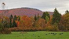
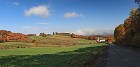
 153 Red Barns I found this picturesque farm just off Kirby Mountain Road, a wonderful dirt path that cuts through the heart of the rugged terrain of the Northeast Kingdom between East St. Johnsbury and Victory State Forest. I framed the image using another barn that, oddly enough, was standing pretty much by itself right by the side of the road. Have you ever wondered why so many barns in New England are red? Well, in the old days, there were no commercial paint products, so farmers would brew up their own concoctions to try to seal the wood and make it last as long as possible. A common formula began with a base of linseed oil, to which various additives were added, including rust, which helps retard the growth of fungi and moss. Today, farmers can paint their barns any color they like, but they tend to be a traditional lot, and red has remained by far the most popular choice. |
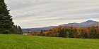
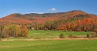
 154 Kirby Mountain Road Panorama A wider view of the same farm as in the preceding image, with more of the surrounding countryside, on a beautiful autumn afternoon. |
 155 Victorious Viewpoint Kirby Mountain Road is a bit of an oddity in that its name changes to Victory Road in the middle, and then changes back again about a mile later. (Why? I have no idea.) The "victorious" part is mostly around the road's highest elevations, where it gets rather rough and tumble, especially if you're not in a four-wheel drive vehicle. This view of dazzling foliage was taken from an elevation of about 2000 feet, not far from where the road peaks at around 2200 feet before descending again. Although it was a bit hazy (due to unusually warm and humid weather) on the left side you can see down into one of the Northeast Kingdom's many valleys. |
 156 Not a Bad Place to Build A House This homeowner in East Burke knows that location is what it's all about when it comes to real estate. |
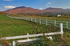 157 Fencelines Simple white fences enclose this parcel of land on Darling Hill Road in East Burke. The longer fence runs east from where I was standing, towards Burke Mountain, the prominent peak center-left; it has a toll road that goes to the top, which I've traveled before, though I skipped it on this particular trip to the Kingdom. The smaller summit on the right is, I believe, Kirby Mountain. |
 158 Opened Sky As my last day in the Northeast Kingdom progressed to mid-afternoon, large banks of clouds started to pass across the southern part of the sky, breaks in them creating beautiful sunrays shining down on the rural landscape. Sunrays can be very hard to photograph when they occur hours away from sunrise or sunset, because of the high contrast scenes they create. I captured this one on Burke Road in Sutton, a few miles north of the town of Lyndon. |
 159 Another Storm Approacheth The foliage season of 2012 in the Northeast Kingdom was an exercise in frustration for many photographers. It started out with beautiful weather, but the color hadn't changed yet. Then the color became the best it had been in years, but the weather got awful. Of course, the good (cold) weather early in the season is part of why the color got so good, so this is really a case of not being able to be lucky forever when it comes to weather. :) But it still drove a lot of photogs crazy that we had one storm after another. This final day that I was up in the NEK, the color was already starting to fade, but I got most of a day of weather cooperation before yet another in a train of storms started moving in from the west at about 3:00 pm. This panorama, looking northwest, shows the leading edge of the storm clouds heading over the northern Green Mountains and the northwestern part of the Northeast Kingdom. Notable on the horizon dead center is the distinctive "slot" where Lake Willoughby was carved out from the rock by glaciers, creating Mount Hor on the left, and Mount Pisgah on the right. Collectively, these features are sometimes called "Willoughby Notch". |
 160 Rocky Lake Willoughby By late afternoon, the skies had almost completely clouded over, and I was well on my way to getting skunked in the sunset department yet again -- I caught a couple of great sunrises on this trip, but was flummoxed by five straight days of cloudy horizons as the sun went down. I was planning to move on to shoot in Quebec, so I began to head north, and as I passed Lake Willoughby, I noticed that the trees on the slope of Mount Pisgah were spectacular. The color here had progressed nicely from when I had been here three days earlier -- see the pictures of Lake Willoughby from earlier in this SceneSet -- and the foliage was now peaking, even though most everywhere around me was well past. (The presence of the water probably has something to do with that. It tends to slow down color change.) I got out of my car and walked along part of the trail that leads around the south shore of Lake Willoughby, where I found this nice alcove, dominated by a huge boulder. I waited for the sun to sneak through some gaps in the clouds and light up the trees, which took a while since there were a lot more clouds than gaps by this point... |
 161 The Road North This was the last image I took in the Northeast Kingdom on this trip, the morning I left Vermont to head north into Quebec. This isn't actually the road that heads to the border crossing, of course -- I'm taking a bit of artistic license with the title. :) It's a pretty dirt road, through mostly beech forest, that I found in the town of Derby, just east of Lake Memphremagog and about two miles south of the Canadian border. |
 162 Night Noyes The photos in my SceneSets are usually presented mostly in chronological order, because I consider myself a "landscape photojournalist", and part of my goal in showing you my images is to evoke the sense that you're accompanying me on my journey. But I like to cheat once in a while, so I close this photographic sojourn through the Northeast Kingdom by returning to Noyes Pond, which was probably the favorite new spot I found on this trip. This was taken on my last full day in northeastern Vermont, at around 5 o'clock am on a beautiful, still, clear morning. You can see some blur in the boats as they bobbed and shifted during this 14 minute exposure, which created longer star trails than you've seen in night shots elsewhere in this set of photos. As you may be able to tell from the semicircular pattern of the trails, the view is slightly west of north -- unfortunately, I just missed getting Polaris in the shot, which is slightly above the right side of this view. |